Precision Experts: Cost-Effective 3D Laser Scanning Services

As one of the largest 3D laser scanning service providers, we bring expertise and experience to deliver cost-effective solutions that revolutionize design, construction, and documentation processes.

Our advanced scanning technology captures detailed and accurate data of physical objects and spaces, providing a foundation for precise measurements, analysis, and visualization. PMC utilizes 3D laser scanning to enable Digital Twins, enhance Industry 4.0 projects, provide detailed assets for BIM, and 2D/3D CAD solutions.
+5000

Projects Completed

+1 Billion

SQFT Scanned

+700

Satisfied Customers

+20 years

Laser Scanning Experience

3D Laser Scanning Services Can Improve Your ROI

Tap into our wealth of experience for affordable, seamless 3D laser scanning. Uncover how our expertise ensures top quality at cost-effective prices.

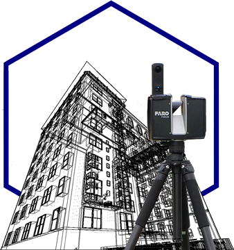
CAD renderings created from point clouds captured via FARO Laser Scanner and Drone

Benefits of 3D Laser Scanning Services

  • Allows for accurate and precise measurements of objects, structures, and environments
  • Facilitates better collaboration among project stakeholders
  • Reduces the time required for data collection
  • Allows captured 3D data to be visualized, analyzed, and manipulated in virtual environments
  • Eliminates the need for manual measurements
  • Provide a common and accurate digital reference, reducing misinterpretations
  • Improve retrofitting, renovations, and design modifications.
  • Reduce the need to physically access hazardous or hard-to-reach areas.
  • Provides accurate as-built documentation.
Get a competitive laser scanning quote today!

    Our 3D Laser Scanning Services Capabilities

    Architecture

    Utilize for detailed as-built documentation, precise measurements, and immersive visualizations. From design analysis to preservation and renovation, leverage this technology for efficient and accurate outcomes in both greenfield and brownfield sites.

    Construction

    Facilitate accurate site documentation, clash detection, and construction progress monitoring, improving project coordination, reducing errors, and enhancing overall construction efficiency.

    Engineering

    Enable precise as-built documentation, structural analysis, clash detection, and efficient design verification, enhancing project planning, minimizing risks, and optimizing engineering processes.

    Transportation and Infrastructure

    Capture detailed and precise measurements of roads, bridges, tunnels, and other infrastructure elements, facilitating efficient design, maintenance, and asset management.

    Urban Planning &Development

    Provide valuable data for accurate mapping, modeling, and analysis of existing urban areas, supporting effective planning, development, and revitalization projects.

    Real Estate

    Provide accurate property documentation, virtual tours, and precise measurements. Support smart city development by offering data-driven insights and immersive visualizations.

    Facilities Management

    Enable precise asset management and maintenance planning. Seamlessly integrate BIM to FM for efficient facility documentation and management.

    Manufacturing

    Enable layout optimization and MEP coordination, improving productivity and minimizing errors, with precise as-built documentation and measurements.

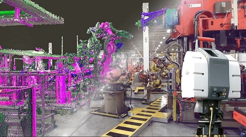
    Laser Scanning Services for Manufacturing

    • Point Cloud with Viewing Software
    • As-built 3D CAD Model
    • Plan, Elevation & Section Drawings
    • Fly-By, Orbit, or Walkthrough Videos
    • Virtual Reality Environments

    Why Choose PMC

    • PMC's advanced 3D laser scanning delivers precise, high-quality data in any setting.
    • Customized reality capture solutions by PMC suit any project size, from single buildings to multi-site ventures.
    • As a diversely skilled laser scanning company, PMC offers varied scanning options, including fixed, mobile, and photogrammetry.
    • Our team ensures quick data delivery and efficient collaboration with advanced software and cloud management.
    • PMC meets diverse industry timelines, providing timely, quality data.

    Related Service: Building 3D Scanning

    Our advanced building scanning technology enables us to create precise digital models of buildings and structures. Our 3D laser scanning services capture detailed point-cloud data and transform it into CAD models with exceptional accuracy. This allows us to capture and preserve the physical attributes and intricate details of structures, providing significant advantages in architectural design, renovation planning, facility management, and historical preservation efforts.
    Frequently Asked Questions

    What is 3D Laser Scanning?
    3D laser scanning is a technology that enables the capture of precise three-dimensional measurements and data of physical objects or environments using laser beams. It involves the use of a 3D laser scanner, which emits laser pulses towards the target object or scene and measures the time it takes for the laser beams to return to the scanner. By calculating the distance and angles between the scanner and the target points, the scanner generates a point cloud—a collection of millions of individual points in 3D space that represent the surface geometry of the object or environment.
    What is 3D Laser Scanning Used For?
    3D laser scanning is widely used across industries for applications such as precise data capture, design and quality control, cultural heritage preservation, surveying and mapping, forensics, mining, environmental monitoring, and virtual experiences.
    Who Could Benefit From Using 3D Laser Scanning?
    Several industries and professionals can benefit from using 3D laser scanning. Here are some examples: Architects and Engineers, Construction Professionals, Manufacturers, Surveyors and Land Managers, Cultural Heritage Experts, Forensic Investigators, Mining and Resources Industry, and Environmental Scientists
    What Are The Benefits From Using 3D Laser Scanning?
    3D laser scanning offers benefits such as accurate data capture, time and cost savings, enhanced visualization, improved design and planning, quality control and inspections, efficient documentation and preservation, safety and risk mitigation, collaboration and communication, asset and facilities management, and data integration with BIM platforms.
    What is Reality Capture?
    3D reality capture is a process that involves capturing the geometry, appearance, and spatial information of real-world objects or environments to create accurate digital representations. It combines advanced technologies such as 3D laser scanning, photogrammetry, and depth sensing to capture data from multiple viewpoints and angles.
    Are 3D Laser Scanning Services Affordable?
    The affordability of 3D laser scanning services can vary depending on several factors, including the complexity of the project, the size of the area to be scanned, the required level of detail, and the specific service provider. While 3D laser scanning technology has become more accessible and cost-effective over the years, it is still considered a specialized service that requires expertise and specialized equipment.
    When would you use Laser Scan Services?
    Laser scan services provide precise and comprehensive data capture in various applications. They are used in construction and architecture for as-built modeling, clash detection, and renovation planning. In engineering and manufacturing, laser scanning ensures quality control and improves processes. In facility management, it aids in space planning and maintenance scheduling. Laser scanning is also valuable for cultural heritage preservation, forensics, surveying, mapping, and virtual reality experiences. Its versatility and accuracy make it indispensable across industries.
    Who uses 3D Laser Scanning?
    3D laser scanning is used across industries for data capture and analysis. Architects and engineers rely on it for accurate measurements, construction professionals use it for site documentation and quality control, and manufacturers optimize processes with it. Facility managers, archaeologists, forensic investigators, surveyors, and GIS professionals also benefit from 3D laser scanning. Its versatility and accuracy make it an invaluable tool for data capture in various fields.
    What types of output files can be obtained?
    3D laser scanning produces various output file formats, including point clouds (RCS, XYZ, PTS, PCD) for detailed spatial data, meshes (STL, OBJ, PLY) for surface representation, 3D models (FBX, COLLADA, STEP) with textures and details, 2D & 3D drawings (RVT, DWG, DXF, PDF) for traditional documentation, and formats compatible with VR and AR platforms. The choice of format depends on the desired use and software compatibility.
    How long does Laser Scanning take?
    The duration of a laser scanning project depends on factors like scanning area size, level of detail, scanning technology, methodology, and site conditions. Larger areas and higher levels of detail may increase scanning time, while advancements in technology can improve efficiency. Consulting a professional scanning service provider is recommended for an accurate project timeline.

    Let our experts show you how 3D Laser Scanning Services can benefit your organization or community

    Send a message to our team by filling out the form below. Describe your project, ask questions, or even request a bid.
    An expert from our team will be in touch with you within one business day!

    Want to schedule a time to speak with one of our 3D Laser Scanning representatives NOW?